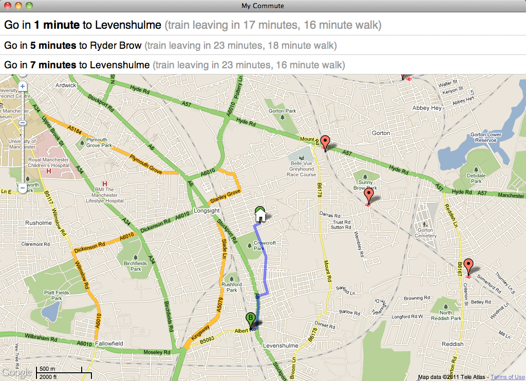
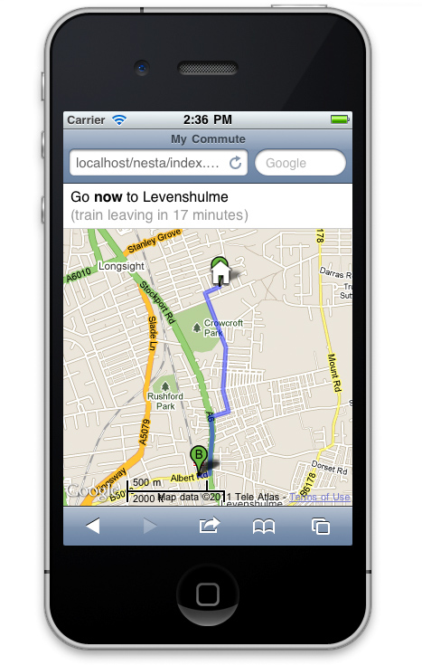
Yesterday I attended the NESTA / Rewired State Make It Local hack day. Myself and five other developers were challenged to create something useful with local data in six hours. My contribution was “My Commute”, a travel planning web site for your daily commute to work.
The idea for My Commute was inspired by Paul Hammond’s excellent Minimuni, which is a great way to find your next San Francisco Muni to work… if you happen to live in Paul Hammond’s house. I wanted to make something similar available to anyone in a given area, based initially on the transport data opened up by Transport f0r Greater Manchester.
This proved to be a bit too much to achieve in six hours, but I made a good start – specifically in showing how the journey options and walking routes could be visualised. Here are a couple of screenshots of the day’s work in action, as viewed on a laptop and on a mobile device. Click on the screenshots to see a full-size version.
(The prototype site is held together by a few too many pieces of string and Sellotape to make it publicly available to play with, but I’ll try and hack it more into shape if time permits.)
The idea is pretty simple: click to set your work location, click to set your home location, and the system will work out the best trains and metros for you to catch right now, based on walking times (from the Google Maps API) to nearby stations, and scheduled times of departure. It will also give you an idea of how soon you’ll need to leave to catch a given service. It updates in real time, to show the best options for right now.
One of the key principles is that it considers all transport options, and all nearby stops. Not every journey will be from a stop just down the road, but often a slightly longer walk can lead to a quicker overall journey, especially in larger cities.
There are plenty of things missing from this hack:
- I didn’t have time to get Manchester’s bus stops into the list of departure points (there are a lot of them, and the data mangling was a step too far for a one-day hack). This would have improved the number of journey options considerably.
- More importantly, the system isn’t yet using actual travel data. Manchester have made all of their bus timetables available in CIF format, but there wasn’t time to get this into a queryable format.
- Even if I had, the data would have been scheduled data, not real-time data. Making real-time data feeds available (assuming the data exists) would make the system more useful. You can still deduce likely arrival time from the scheduled timetable (as in this live bus map from a previous Rewired State event), but it doesn’t take into account any late-running services.
- The journey time from the recommended stop to your actual destination isn’t yet taken in to account when calculating the best option for you to take.
- The walking time is based on Google’s best estimate, and doesn’t provide alternatives for cycling or taking the car at the start or end of your journey.
Still: it’s a start! Thanks to NESTA and Rewired State for the opportunity to put it together.

